OSM: GSoC blogs on Planet-OSM
All the OpenStreetMap Google Summer of Code 2008 student blogs are now on Planet-OSM, the feed aggregator for OpenStreetMap related blogs.
All the OpenStreetMap Google Summer of Code 2008 student blogs are now on Planet-OSM, the feed aggregator for OpenStreetMap related blogs.
Yesterday I took part in the first Edinburgh 20 miler ride of 2008. It was an easy, slow paced, group ride of 12 people around the west of Edinburgh. In total for the day, including to and from the start/finish I cycled about 26 miles.
Last weekend's Edinburgh Mapping Party went well. We had around 10 mappers at the meet up. Most of FIXME land has now disappeared.
Google Maps now has a great route planning feature called "avoid highways". This produces routes that don't go on to motorways and some trunk routes, such as the Edinburgh City Bypass, where cyclists are not allowed. It still isn't perfect for cyclists as it doesn't allow for some
roads that cyclists are not allowed on. However it is a step in the right direction for route planning for more experienced cyclists who are happy to cycle on main roads rather than the quieter National Cycle Routes.
It also still routes cyclists on some roads that cyclists are banned from using, such as the West Approach Road in Edinburgh.
See example map that shows this problem.
Another problem is where the route planner takes you a much longer way than you would expect. For example Edinburgh to Dundee avoiding highways takes you via the Kincardine Bridge, this is fine if there is high winds and the Forth Road Bridge is closed to high sided vehicles and pedestrians/cyclists. However that is significantly longer than going via the Forth Road Bridge.
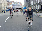
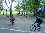
Yesterday I cycled in the Edinburgh Critical Mass.
The idea about Critical Mass is to raise awareness of cycling. A large group of cyclists just get together and cycle around a city as a group. It is completely unorganised except the starting location and time. No route is planned in advance. Anyone in the group can decide to take the lead and the route is chosen on the fly by consensus.
In Edinburgh, on the last Friday of every month at 17:30 for 18:00 set off, a bunch of cyclists get together at the the foot of the mound beside the National Galleries of Scotland. The cycle takes around an hour or two.
 |
| From 20070525Criti... |
 |
| From 20070525Criti... |
I thought I would checkout how I would get from Edinburgh to the WWDC in San Francisco. Head over to Google Maps, and search from Edinburgh to San Francisco. Take a look at item 41, which is 3,462 miles long.
(Is anyone up for the swim?)
Yesterday I took a long 80 mile cycle. Initially I headed West from Colinton in Edinburgh through to Airdrie. In Airdrie I lost track of the sign posts for the National Cycle Route 75. So I headed North to the Forth and Clyde Canal to Falkirk. At Falkirk I joined the Union canal home.
There was only 2 hilly sections of the route. There is a steady climb from Colinton to Balerno. Though from Balerno towards Kirknewton there is a steep downhill. Heading from Airdrie to the Forth and Clyde Canal there were quire a few hills that I went over.
Along the Bathgate to Airdrie section there is a series of large artworks along the path.

At Falkirk the sun was setting behind the Falkirk Wheel as I was passing.
I was surprised that I didn't get another puncture going through Livingston or on the Airdrie side of the Bathgate to Airdrie Cycle Path, with the amount of broken glass lying around.
The longest cycled in one day was about 70 miles to Berwick Upon-Tweed. So yesterday set a new record. Not much more now until I cycle 100 miles in one day.
Today I came across mapping wiki style. OpenStreetMap aims to provide free geographic data of the whole world.
The current problems with most maps is that they are have copyright on them, and they have special easter eggs or gotchas to determine copying of the maps. This is a problem for projects that need to be able to use maps in the form of free speech, rather than free beer. Google Maps for example can be used like free beer, but not in the form of free speech.
The amount of data available is currently fairly low, so I would start using the maps for major map planning yet. However you can help, by mapping some part of the world that you know well.
I have recently been using MapMyRide.com for mapping out my Cycle trips. It uses Google Maps, which unfortunately does not contain enough information like the canals for example. This makes it difficult to do some mapping, especially in areas where their maps are of low resolution.
For a while it has been impossible to upload photos to Frappr maps using Mac OS X. The Frappr team have recently got it sorted out, so I can now add my updated photo the the current OpenOffice.org Mac OS X Porting Developers map.


