Showing posts with label Edinburgh. Show all posts

Monday, March 03, 2008

OSM cycle map of Shandwick Place, Edinburgh diversion

For the next five months Shandwick Place in the west of the centre of Edinburgh is closed for work to move the utilities for when the trams are going to be introduced in a few years time.

The council, TIE and Lothian Buses were quick enough to produce alternative routes for cars and buses, however their alternative route wasn't suitable for cyclists.

On Friday they provided some written instructions without any maps, which they had done for the car drivers and bus routes.
See below for a map with the council's route drawn on top of Andy Allan's rendering of the OpenStreetMap cycle data.


Sunday, February 17, 2008

Cycling: Edinburgh to Berwick and Back

Further to my previous post about my bike. I had problems getting a proper chainring from half the bike shops in Edinburgh, so instead I got a second hand bike that was similar to my old one. 


Just over a year ago, I cycled from Edinburgh to Berwick-Upon-Tweed. Since then I have been trying to do it in both directions. However the past occasions that I tried to do it something came up. On Saturday I left home for a rather long cycle. Before I left I loaded TrekBuddy with a map of South East Scotland so that I had some idea of where I was.

The overall cycle was tough. First I headed out East from Edinburgh through Musselburgh on to the A199, out to Dunbar. Parts of the A199 have some nice cycle lanes. As the road is fairly flat and straight you can easily get the speed up to do a nice sprint. This was the easy part of the route, as I have done it before.
P1000025.JPG P1000035.JPG

At Dunbar I started to head south towards Berwick-Upon-Tweed. Parts of this part of the A1 can be scary, however it the only way south close to the coast that I know of. In the middle of the Borders, I decided to head through Pease Bay again. It is a steep road down to the bay, where the caravan park is, however it is even steeper on the other side heading out of the bay.

As I had the map in TrekBuddy, I was able to find the A1107, which joins the A1 with Eyemouth in a loop. This helped me to stay off the A1 for a lot longer than I did the last time. It was a nice road into Eyemouth, with some great views of the North Sea. From Eyemouth I headed along the "Berwickshire Coastal Route", which meant that I was on the A1 for even less, and I'd have even more data to be able to add to OpenStreetMap.org.
P1000132.JPGP1000140.JPG

At the border between Scotland and England, I took a snack and photo break.
P1000175.JPG P1000181.JPG
From the Border, it is only a few miles more into Berwick, where I joined the National Cycle Network Route 1 to head back to Edinburgh.
P1000187.JPG P1000212.JPG
The National Cycle Network takes you on the quietest roads possible. This will usually mean that they are quite hilly, longer and going into the middle of nowhere.  There were some points where you could just see fields or trees, but no lights apart from my own bike or the occasional car. As you are heading west along the National Cycle Network, it does zig zag between Scotland and England a few times. At one point there is a bridge that was built in 1820, and still in use today.
P1000219.JPG P1000226.JPG

In Norham there was a sign that was rather confusing, as it had the wrong National Cycle Network Route number. Just as well I used the name of the city I wanted to head towards, rather than the route number.

Just before Galashiels, I stopped to check the GPS and found that the phone no longer seen it. Unfortunately the battery in the bluetooth GPS that I'm currently using only lasts for about 12 hours according to the manufacturer. It lasted about half an hour longer, than the manufacturer's stated operating time, so should I be happy that I couldn't get the last bit of the trip? The cold weather didn't help either, as batteries tend to have a shorter life when they are cold. 

From there on, there was no point in me taking any more pictures as I wouldn't be able to Geotag them. Also it was dark so it was difficult to take any decent pictures. Finally stopping to take pictures does slow my average speed down considerably, and I was wanting to get home rather than be on the bike for a whole 24 hours.

From Galashiels I just hit the A7 north to Edinburgh. I did notice on the way that the signs appeared to change from green to white like a yo-yo. Is it a trunk road or a primary road?

Total Distance was about 150 miles in 17 and three quarter hours. Next up on the longer distance cycling is to head round the Forth again.

Now I just need to get the tracks from yesterday added to OSM (amongst the numerous other things I need to do).


Saturday, January 19, 2008

Cycling:Saturday CTC cycle 2008-01-19

Today I took part on the CTC Saturday cycle for the first time. Total distance including getting to and from the start and finish was 51 miles.


As I raced to the meeting point of the Commonwealth Pool, I found the first part of the ride slow. Later on, especially with the head wind I found the pace of the group to be about right. I'm not able to sustain a high speed over a long enough distance to be able to move up to the next level of the road club.

Sunday, January 13, 2008

Cycling: Edinburgh 20 miler

Yesterday I took part in the first Edinburgh 20 miler ride of 2008. It was an easy, slow paced, group ride of 12 people around the west of Edinburgh. In total for the day, including to and from the start/finish I cycled about 26 miles.


I found parts of the route interesting because I hadn't come across them before. I was also testing out my new GPS linked to my phone, using the TrekBuddy software. It seemed mostly reliable, though there was a couple of points where the phone locked up, or there was sporadic data. The sporadic data was easily filtered by gpsbabel. It was also nice to be able to have cached OSM data on my phone, so that I could see where there was changes required to the data.

Saturday, August 11, 2007

Cycling: Bike Repairs

Today, I was intending to cycle from Edinburgh to Berwick-upon-Tweed and back. Unfortunately on leaving the lights a Regent Road to head down on to London road, my gears started making a grinding noise.


Gears 5-8 all made a horrible noise. Luckily I still had gears 1-4, though unfortunately I had a top speed of only about 15 miles per hour, which is way too slow when on the road. I cycled down to Halfords at Seafield to see if they could see what the problem was. One of the guys at the BikeHut took a look and said that I could either wait about 10 days for a gear service (£14.99), or replace the gear cable myself, which probably would be the problem (£1.99). 

The old gear cable has had one of the strands lose in parts of the cable. However the change of the cable hasn't made the noise go away. So it seems that the gear unit will need to be opened for an half yearly service. I also need to get a new chain and front cogs for it too some time soon. :-( 

At least I did manage to do some more mapping for OpenStreetMap.org, so it wasn't a completely wasted journey.

Sunday, August 05, 2007

Cycling: Edinburgh and Galashiels circle

Yesterday I took a cycle south on the National Cycle Network route 1. 


 I headed out on the Lasswade Road, towards Bonnyrigg, where I joined the NCN1.

It was quite a nice day, with some awesome views in parts of the route.

From 20070804osmcy...
One of the great things about being on a push bike, is that you can ignore "Road Closed" signs, instead of taking a long diversion. In this case, a bridge on the National Cycle Network was getting replaced. Though there was a temporary scaffold bridge available for use by cyclists and pedestrians.
From 20070804osmcy...
Parts of the journey were quite tough, even so they were downhill on quiet roads, there was a strong head wind. At Innerleithen, I stopped for a short break to grab a pizza, so that I would have enough energy to get back home. From there the cycle route starts heading east to Galashiels and Melrose. 

From 20070804osmcy...
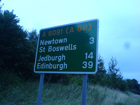
After Melrose, I decided it would be better to head back home rather than continuing south on the national cycle network. At that point I seen a distance sign that said that Edinburgh was 39 miles away on the A68. At that point I predicted that I'd be home some time between 12 midnight and 1 am.

As I was heading up the first part of the A68, which was quite a bit of uphill, I was starting to extend my prediction as to the estimated time of arrival home. However the downhill at the other side made up for the extra time to get up the hill, with me arriving home around quarter past midnight. 96 miles in 9 hours 45 minutes is pretty good, with a few breaks. It is however only a third of the speed required for setting some UK Road Records.

While I was out on my travels, I collected a nice track log of  my journey, so that I could add it to OpenStreetMap.org.

Sunday, July 29, 2007

Cycling: Edinburgh Critical Mass: July 2007

On Friday I went along to the monthly Critical Mass again.


I managed to arrive just in time this month for them setting off from the foot of the Mound at 6pm. This month seems to have been busier that the previous two months. There was about 44-55 people on their bikes there.

This month there was no major problems. Unfortunately at a few points there motor vehicle getting into the middle of the group, but we managed to sort that out quite quickly. Also on our way up Leith Street, when we were stopped at the traffic lights, there was two police cars coming up behind us with their sirens blaring and lights flashing. Unlike motor vehicles, we were able to rapidly shift over to one side of the road and on the pavement and let them past.

In true Critical Mass style at the last minute, we decided to head to an off-licence and then the Meadows for the after cycle drink and chat instead of the usual trip to The Peartree pub.

Unfortunately the GPS has gobbled my GPS logs again, so I had to re-create the route from memory.

Saturday, July 28, 2007

Cycling: Glasgow to Edinburgh

On Thursday evening, I took the train over to Glasgow for the Scotlug meeting. There was an interesting presentation about phidgets. Afterwards I went along with the other geeks to the pub to grab something to eat and have a natter. I've even now seen an iPhone (not just in pictures), though not yet had a chance to play with one.


After 11pm, I set off back to Edinburgh. On my bike. I could have taken the train, but that would have cost more and I was needing the challenge of cycling over night home.

I headed North from George Square to the Glasgow spur of the Forth and Clyde Canal. I then followed the Forth and Clyde Canal, the whole way to the Carron Sea Lock, where I then hit the road for the rest of the way home (except the cycleway parallel to the A90 from Dalmeny to the Crammond Brig pub, where cyclists are not allowed on the trunk road).

By the time I was nearing South Queensferry, first light was starting to show. See the picture below, where you can just about make out the towers of the Forth Road and Rail Bridges.
From 20070727Glasg...

The journey took 5 hours, and was about 53 miles in length. It's not very often you'll see me arriving home at 4:20 am.

The greatest thing about cycling at night is that the roads are really quiet, especially after 1am. It also makes cycling on the bigger roads a lot easier, and saves you from having to use the quieter and hillier routes. It can also be faster as you don't have to deal with other traffic or air turbulence caused by other traffic.

I'd be quite happy to do it again, as long as I don't need to get up the next day before lunch time.

Saturday, July 07, 2007

Some people thought that I done a lot of cycling?


Many people have commented on the various day cycling trips that I've taken. However yesterday when shopping, I found someone who has been doing a lot more cycling than myself. He took the train from Cambridge up to Inverness. Then he started cycling and camping rough. That was two months ago. 


He was taking everything he needed in panniers on his bike. He was looking at doing around 50 miles each on the way back down to Cambridge.

See the attached photo of his bike with the panniers full.

Sunday, July 01, 2007

Cycling: Critical Mass: Edinburgh June 2007

On Friday I headed to the Edinburgh Critical Mass again. It was a lot busier than last month, which meant that it was better perceived by the public.


As the route of the Critical Mass is not predefined, it is very easy to change the route. When we tried to turn right from Princes Street into North Bridge, no vehicles were allowed, so instead we headed down Leith Street.

Part of the Critical Mass route (I was late so it's missing the start).

After Critical Mass, I took a little detour home by going via Crammond Island.

I've stuck the photos on to Flickr seemingly Yahoo maps doesn't actually have Crammond Island.

Thursday, June 14, 2007

Cycling: Edinburgh to North Berwick

Last Night I took a cycle out to Prestonpans. I then took the train to North Berwick for £2.50, and cycled all the way back to Edinburgh. 


I was originally going to cycle to North Berwick, though unfortunately I had a head wind, which would have meant I would have missed the last train from North Berwick towards Edinburgh. The route that I changed to was also cheaper, because if I had gone all the way to North Berwick to take the train back, I would have taken the train all the way back to Edinburgh. That would have cost nearly twice as much.

I have also got the North Berwick branch line and the coast road into Edinburgh mapped on to OpenStreetMap.org. The signal of the GPS on the train wasn't perfect the whole way

Maps:
Edinburgh -> Presontpans (16 miles about 1 hour 20 minutes)
North Berwick -> Edinburgh (30 miles about 2 and a half hours)

Saturday, May 26, 2007

Cycling: Edinburgh Critical Mass

Yesterday I cycled in the Edinburgh Critical Mass.

The idea about Critical Mass is to raise awareness of cycling. A large group of cyclists just get together and cycle around a city as a group. It is completely unorganised except the starting location and time. No route is planned in advance. Anyone in the group can decide to take the lead and the route is chosen on the fly by consensus.
In Edinburgh, on the last Friday of every month at 17:30 for 18:00 set off, a bunch of cyclists get together at the the foot of the mound beside the National Galleries of Scotland. The cycle takes around an hour or two.

From 20070525Criti...


Some photos that I took on Flickr
Same photos on Picasa Web Albums
The route
GPX Trace

Cycling: Edinburgh to Dunbar

On Wednesday I cycled about 36 miles from Edinburgh to Dunbar in just over 2 hours. The tail wind and my significant amount of recent cycling helped with the short duration. I lazily took the train back.

From 20070523Edinb...

From 20070523Edinb...

Map of ride (no track points between Dunbar station and Edinburgh Waverley station).

Sunday, April 29, 2007

Cycling: Edinburgh to Croy via Glasgow and Bowling

Yesterday I cycled 140KM (87 miles). I first headed out to Balerno along the Lanark Road, where I joined the National Cycle Route 75. I followed it as best as I could all the way into Glasgow. Along the Clyde I switched over the the National Cycle Route 7, which took me out to Bowling, where I took a break at the Bowling Basin/Harbour. Bowling is where the Forth and Clyde Canal joins the River Clyde.

Unfortunately I managed to get 2 punctures from the rim side of the inner tube. The first around Coatbridge I managed to fix. After that I got all the way to Bowling and then start heading back along the Forth and Clyde canal. At the towpath access point for Kilsyth and Croy I got a second puncture in another place again on the rim side of the tire. I tried to fix it, but as soon as I got it all back together, I start to hear a high pitched whistle coming from where I just fixed the puncture. The tire was flat within minute. It was getting dark and it was still about another 20 miles to Falkirk, so I decided to head to Croy station and get the train from there back home for £6.05.

It wasn't all that bad, it seems to be the second most I have cycled in one day. Maybe I'll get around to doing the trip again and set myself a new record for how far I can cycle in one day.

Some photos of my trip

Maps of the trip (in 4 sections):
Edinburgh -> Livingston
Livingston -> Puncture Repair 1 (Coatbridge)
Puncture Repair 1 (Coatbridge) -> Bowling
Bowling -> Kilsyth/Croy on Forth and Clyde Canal

Tuesday, April 10, 2007

Cycling: Edinburgh to Glasgow and back

On Saturday I cycled from Edinburgh to Glasgow along the National Cycle Network Route 75 (except the bits where I missed some signs and got lost). Then to get back home I used the Forth and Clyde canal to Falkirk, where I switch to the Union Canal back into Edinburgh.

This is the first time that I have knowingly cycled over 100 miles in one day. It took me about 12 and a half hours to get there and back. I was expecting it to take another hour or two to do the journey. Heading West took longer due to the head wind and getting lost a few times due to the National Cycle Network not being well sign posted in places and not having been in the area before.

Going through North Lanarkshire isn't particularly great on the bike due to the very high amount of broken glass lying around on the cycle paths. Livingston has some glass lying around in a few places, but it is no where near as bad as heading through the North Lanarkshire council area.

Google album:

Cycling Edinburgh to Glasgow and back


See the route.

Saturday, March 24, 2007

Union Canal resurfacing in Edinburgh

Today was the first time that I cycled along the Union Canal from the canal basin near Tollcross in Edinburgh to Wester Hailes in the West of the City. The surface was very smooth and without the potholes that were there before. In many places, the path is wider than what it was before.
The nice weather has also got people out, as the canal towpath was fairly busy, compared to what I have seen it before.

Monday, February 19, 2007

Cycling: Edinburgh to Glasgow

On Saturday I took a cycle along the Union Canal to Falkirk and then the Forth and Clyde Canal to Glasgow. It was a total of about 60 or 70 miles.

I timed it nicely for getting into Falkirk as I got to see the Falkirk Wheel turning.


It was a really nice day for the cycle, with only a short shower of rain just after Falkirk. The great thing about cycling along the canal towpaths, is that it is fairly level all the way along the route. However, the towpath in places is very muddy.

I took the train home from Glasgow Central to Wester Hailes. At £4.35 it was cheaper than going from Glasgow Queen Street to Edinburgh Park, which is more frequent, but requires a change to get there.

Monday, January 29, 2007

Cycling: North Berwick this time

On Saturday I took a 30 mile cycle out to North Berwick. The tail (westerly) wind did help, and helped my decision on whether to cycle west, north or east.
I took a couple of stops along the way for refreshments. I got into North Berwick about 5pm, just as the sun was setting.
When I got to the train station, the train was due to leave in about 5 minutes time. There was an announcement to say that it was 10 minutes late. Did it appear? Nope. The next one appeared and left on time though. One thing that I noticed is that with the train being electric, it is considerably quieter than the desiel trains that run between Edinburgh-{Glasgow, Bathgate, Fife via Stirling}.

Friday, November 25, 2005

Buses back on George Street

It seems as though there is at last going to be some buses using
George Street again, through the reversal of the Central Edinburgh
Traffic Management Scheme (.

See web site.