Showing posts with label Cycling. Show all posts

Tuesday, July 22, 2008

Cycling: South London Critical Mass

Quick catchup post. On the First Friday of July 2008, the first South London Critical Mass was held. On the way I done some mapping for OSM, finding some unnamed roads. I find Critical Mass useful for learning your way around London (or wherever it is held), as through random route will take you to parts of the city you have never been before.


Some photos (Just noticed that the Geotagging of the last few failed):


P1030522.JPG P1030506.JPG
P1030555.JPG P1030583.JPG
P1030610.JPG P1030653.JPG
P1030660.JPG Seems that Critical Mass passes by fuel stations awaiting deliveries.
P1030673.JPG I wonder how Bird In Bush Road got its name.
P1030680.JPG
P1030689.JPG You can try some unusual bikes.

Sunday, June 29, 2008

Cycling: London to Brighton

On Saturday I cycled from London to Brighton. It's the first day long cycle that I've done since I cycled from Bletchley to Bedford and back, over a month ago. Yeah I did lots of cycling at the Woking Mapping party, but there was lots of breaks and cul-de-sacs.


I couldn't even get 10 minutes away, and I managed to get totally confused by the signage for the National Cycle Network route 23. Having the Cycle Map and an intermittently working bluetooth GPS was really useful. Looking at the trace and where the sign posts were it appears that some of the signposts around the South end of South Norwood Country Park are totally ambiguous, alternatively the route has been changed recently. There was a few other places that I had to double back because I had missed a turn.

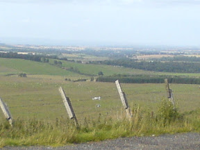
Further south there was some nice views across the hills.

I was quite surprised when I found that the national cycle route goes right through the middle of Gatwick airport

Had a little bit of a wander in Brighton before getting the train home.

I added a few extra pois, road names and the southern end of the ncn 20 into Brighton to the osm data.

In the future I should try and leave before lunchtime, for these day long cycles, which I should do more often.
P1030453.JPG P1030450.JPG P1030457.JPG P1030466.JPG P1030477.JPGP1030479.JPG
And finally Brighton Peir for the first time: P1030488.JPG

Friday, May 23, 2008

Screw in Tire


P1010856.JPG
Originally uploaded by smsm1
Cycling to work, and get a screw in my tire. Just as well it wasn't my front tire otherwise I'd have had to walk the rest of the way, or find a bike shop. Instead I just unscrewed it (and took the screw with me so that the next cyclist doesn't run over it.

Monday, March 03, 2008

OSM cycle map of Shandwick Place, Edinburgh diversion

For the next five months Shandwick Place in the west of the centre of Edinburgh is closed for work to move the utilities for when the trams are going to be introduced in a few years time.

The council, TIE and Lothian Buses were quick enough to produce alternative routes for cars and buses, however their alternative route wasn't suitable for cyclists.

On Friday they provided some written instructions without any maps, which they had done for the car drivers and bus routes.
See below for a map with the council's route drawn on top of Andy Allan's rendering of the OpenStreetMap cycle data.


Sunday, February 17, 2008

Cycling: Edinburgh to Berwick and Back

Further to my previous post about my bike. I had problems getting a proper chainring from half the bike shops in Edinburgh, so instead I got a second hand bike that was similar to my old one. 


Just over a year ago, I cycled from Edinburgh to Berwick-Upon-Tweed. Since then I have been trying to do it in both directions. However the past occasions that I tried to do it something came up. On Saturday I left home for a rather long cycle. Before I left I loaded TrekBuddy with a map of South East Scotland so that I had some idea of where I was.

The overall cycle was tough. First I headed out East from Edinburgh through Musselburgh on to the A199, out to Dunbar. Parts of the A199 have some nice cycle lanes. As the road is fairly flat and straight you can easily get the speed up to do a nice sprint. This was the easy part of the route, as I have done it before.
P1000025.JPG P1000035.JPG

At Dunbar I started to head south towards Berwick-Upon-Tweed. Parts of this part of the A1 can be scary, however it the only way south close to the coast that I know of. In the middle of the Borders, I decided to head through Pease Bay again. It is a steep road down to the bay, where the caravan park is, however it is even steeper on the other side heading out of the bay.

As I had the map in TrekBuddy, I was able to find the A1107, which joins the A1 with Eyemouth in a loop. This helped me to stay off the A1 for a lot longer than I did the last time. It was a nice road into Eyemouth, with some great views of the North Sea. From Eyemouth I headed along the "Berwickshire Coastal Route", which meant that I was on the A1 for even less, and I'd have even more data to be able to add to OpenStreetMap.org.
P1000132.JPGP1000140.JPG

At the border between Scotland and England, I took a snack and photo break.
P1000175.JPG P1000181.JPG
From the Border, it is only a few miles more into Berwick, where I joined the National Cycle Network Route 1 to head back to Edinburgh.
P1000187.JPG P1000212.JPG
The National Cycle Network takes you on the quietest roads possible. This will usually mean that they are quite hilly, longer and going into the middle of nowhere.  There were some points where you could just see fields or trees, but no lights apart from my own bike or the occasional car. As you are heading west along the National Cycle Network, it does zig zag between Scotland and England a few times. At one point there is a bridge that was built in 1820, and still in use today.
P1000219.JPG P1000226.JPG

In Norham there was a sign that was rather confusing, as it had the wrong National Cycle Network Route number. Just as well I used the name of the city I wanted to head towards, rather than the route number.

Just before Galashiels, I stopped to check the GPS and found that the phone no longer seen it. Unfortunately the battery in the bluetooth GPS that I'm currently using only lasts for about 12 hours according to the manufacturer. It lasted about half an hour longer, than the manufacturer's stated operating time, so should I be happy that I couldn't get the last bit of the trip? The cold weather didn't help either, as batteries tend to have a shorter life when they are cold. 

From there on, there was no point in me taking any more pictures as I wouldn't be able to Geotag them. Also it was dark so it was difficult to take any decent pictures. Finally stopping to take pictures does slow my average speed down considerably, and I was wanting to get home rather than be on the bike for a whole 24 hours.

From Galashiels I just hit the A7 north to Edinburgh. I did notice on the way that the signs appeared to change from green to white like a yo-yo. Is it a trunk road or a primary road?

Total Distance was about 150 miles in 17 and three quarter hours. Next up on the longer distance cycling is to head round the Forth again.

Now I just need to get the tracks from yesterday added to OSM (amongst the numerous other things I need to do).


Wednesday, February 06, 2008

Cycling: Bike off the road again

Seems that when I did my last bike repair a month ago, I didn't tighten the bolts that hold the cogs on properly. So the chain ring has managed to fatigue and break quite spectacularly. Luckily I was just setting of from some lights within walking distance from home, so it wasn't too bad.


Unfortunately to get a new one specifically for internal gears, which use a stronger, wider chain, is seen to be a specialist part by the bike shops I've been to so far in Edinburgh. This means that you need some thicker cogs. This means that it takes about a week to get specially ordered in, and means pushing my bike into the city centre to make sure I get the right bit ordered.


Yay I can now use Apple Spell check in Safari when writing blog posts, and it works.

Saturday, January 19, 2008

Cycling:Saturday CTC cycle 2008-01-19

Today I took part on the CTC Saturday cycle for the first time. Total distance including getting to and from the start and finish was 51 miles.


As I raced to the meeting point of the Commonwealth Pool, I found the first part of the ride slow. Later on, especially with the head wind I found the pace of the group to be about right. I'm not able to sustain a high speed over a long enough distance to be able to move up to the next level of the road club.

Sunday, January 13, 2008

Cycling: Edinburgh 20 miler

Yesterday I took part in the first Edinburgh 20 miler ride of 2008. It was an easy, slow paced, group ride of 12 people around the west of Edinburgh. In total for the day, including to and from the start/finish I cycled about 26 miles.


I found parts of the route interesting because I hadn't come across them before. I was also testing out my new GPS linked to my phone, using the TrekBuddy software. It seemed mostly reliable, though there was a couple of points where the phone locked up, or there was sporadic data. The sporadic data was easily filtered by gpsbabel. It was also nice to be able to have cached OSM data on my phone, so that I could see where there was changes required to the data.

Sunday, January 06, 2008

Cycling: New chain and chain rings

I've finally got around to replacing my worn chain and chain rings/cogs on my bicycle. I have gone for 2 extra teeth on the front and one less on the back. This means I'll be getting a few extra turns of the wheel for each turn of the pedals. 


Before putting the new chain on, I compared the two, and the old one had stretched by nearly 2 links over the whole length. No wonder the teeth were wearing away so much, and making so much noise when pedalling. 

On my test ride this afternoon, I noticed it was running a lot smoother. Though it does appear that the hub requires to be pulled apart again to be fully re-greased, though I'm maybe thinking that it will need to be replaced due to the wear.

There are a couple of photos of the old cogs below. Take a look at how worn they are.

Old worn chain ring Compaing old and new chain rings

Sunday, December 02, 2007

Cycling: Edinburgh Critical Mass - St Andrews Day

On Friday I headed in to the centre of Edinburgh for November's Critical Mass. Even before I set off from work in the west of the city, it was pitch black. So I had my lights and reflective jacket on.


About 17:45 a whole load of fireworks started from Edinburgh Castle to mark St Andrews Day. We had a great view point from the foot of the mount between the two National Galleries. There was a couple of points where the fireworks went off in a cross pattern, a bit like the cross on the Saltire (our national flag).

About 50 of us participated in this month's ride. Map of the November Critical Mass ride.

Today I watched the River City omnibus. Friday's episode really emphasised the fact that in Scotland we really don't celebrate Saint Andrews Day. In fact we usually forget that Saint Andrews Day even exists. Over the other side of the pond, Tartan Day is celebrated (at a different time of year), far more than what we do. Are we Scots no use a celebrating? Or are we just too busy working to bother with celbrations?

Sunday, November 25, 2007

The past 2 months

It has been a couple of months now since I've properly written a blog post. So here is a longish catchup post.


I have been busy doing agency work mostly in staff restaurants as a Kitchen Porter. I've even bumped into the Lead of the Marketing Project in our home town, rather than having to go to some OpenOffice.org conference. I did spend 3 weeks commuting by train (a novelty for me), to Stirling to work as a caretaker. Unfortunately the work is rather dull, though there are bills to be paid. Hopefully I'll get around to updating my CV and sending it off to relevant people to hopefully get a degree related job.


Now back to 2 months ago.
I managed to get up and do my Buildbot presentation at ooocon2007 without any breakfast. The presentation has been really useful, as I have received some very useful feedback from developers on what they want from the system.


Code writers are interested in seeing if their code breaks on some other platform as early as possible. They want this to be reliable, and ideally the same configuration as the officially released builds.
The QA project are looking for install sets for testing new code that is about to be introduced into the main code line. Again they ideally want to have the same configuration as the officially released builds.

At the moment the source code statistics aren't interesting enough for developers to want them. Also the basics don't currently work well enough.


I have finally got around to Geotagging my photos from this years OpenOffice.org conference in the past few days. As I have upgraded to Mac OS X 10.5, I found that my previous geotagging solution (GPSPhotoLinker) has stopped working as a library has stopped working due to a perl version mismatch. So I have headed to the command line with a perl script. gpsPhoto.pl seems to do the trick, though it is a pain to get the command line right as it isn't as easy to just drag a load of photos from iPhoto. I'm not upgrading to iLife 08, as there is no GPS tagging support. Leopard's Preview has a feature that allows you to go to a Google map of where the photo was taken. However, what I really want it to tell iPhoto: look in this folder for GPS traces, and geo tag all these photos automatically.

For future reference (as I was in mainland Europe with daylight saving the offset from UTC is minus 2 hours):

./gpsPhoto.pl --gpsdir 2007-09 --timeoffset -7200 --maxtimediff 7200 --overwrite-geotagged --dir /Users/shaunmcdonald/Pictures/iPhoto\ Library/Originals/2007/ooocon2007/

Photos from ooocon2007. I've also added the photos to Flickr with the ooocon2007 tag.

As many people have already seen. I am now the lead for the Mac Port of the OpenOffice.org. Eric Bachard made the announcement some time ago. I have posted my vision to the Mac porting mailing list. Due to time constraints as mentioned at the start of this blog post, I won't be spending as much time as Eric Bachard on the project. I'm sure Eric will do a great job as the lead of the Education project, which tries to get more students involved in the OpenOffice.org project.

I am currently moving broadband provider from VirginMedia to Be*. For the same price I'm getting about 4 times the speed, with a slightly greater dropout for the same £18 per month.


When I was working out in Stirling I cycled home, or part of the way home. I have managed to map and tag most of the National Cycle Network route 76 from Stirling to Kincardine/Grangemouth. The south of the Kincardine Bridge is rather difficult to map and cycle just now as there is a lot of major road works and changes to the road network happening there.

About a fortnight ago I cycle 73 miles from Edinburgh to Ayr along the A70. I left quite late just before midday, and took about 6 hours. With the winter setting in, the last hour was pitch black. I lazily took the train back home for £8.80 with my Young Person Railcard. (Rather than cycling back home.) I have mapped and tagged the A70 with my GPS trace for the OpenStreetMap project. My ride on MapMyRide.com. I probably won't cycle the A71 to Kilmarnock as it is a more dangerous road.


I have created a count down dashboard widget to State of the Map 2008. Download the SOTM countdown widget


Finally, I have partnered with Manager-Pro. To translate and distribute and English version of their software. All exported reports require the usage of OpenOffice.org. Either as the document reader as the exported documents are in the OpenOffice.org 1 format. If a user wants the reports in PDF, Word or Excel formats, OpenOffice.org requires to be installed for the file format translators within OpenOffice.org.

Thursday, August 16, 2007

Cycling: Back on the Road

Today my dad came round and helped me to clean and re-grease my rear hub gears. Now the bike is running a lot better. Almost as though it's now.


However I still need to replace the cogs and chain some time soon, before they wear out completely. As I have internal gears, I can get away with wearing away the cogs for a lot longer compared to other external derailleur gears.

Hopefully I won't need to take it apart for the next 6 months to a year to do another re-grease.

Saturday, August 11, 2007

Cycling: Bike Repairs

Today, I was intending to cycle from Edinburgh to Berwick-upon-Tweed and back. Unfortunately on leaving the lights a Regent Road to head down on to London road, my gears started making a grinding noise.


Gears 5-8 all made a horrible noise. Luckily I still had gears 1-4, though unfortunately I had a top speed of only about 15 miles per hour, which is way too slow when on the road. I cycled down to Halfords at Seafield to see if they could see what the problem was. One of the guys at the BikeHut took a look and said that I could either wait about 10 days for a gear service (£14.99), or replace the gear cable myself, which probably would be the problem (£1.99). 

The old gear cable has had one of the strands lose in parts of the cable. However the change of the cable hasn't made the noise go away. So it seems that the gear unit will need to be opened for an half yearly service. I also need to get a new chain and front cogs for it too some time soon. :-( 

At least I did manage to do some more mapping for OpenStreetMap.org, so it wasn't a completely wasted journey.

Sunday, August 05, 2007

Cycling: Edinburgh and Galashiels circle

Yesterday I took a cycle south on the National Cycle Network route 1. 


 I headed out on the Lasswade Road, towards Bonnyrigg, where I joined the NCN1.

It was quite a nice day, with some awesome views in parts of the route.

From 20070804osmcy...
One of the great things about being on a push bike, is that you can ignore "Road Closed" signs, instead of taking a long diversion. In this case, a bridge on the National Cycle Network was getting replaced. Though there was a temporary scaffold bridge available for use by cyclists and pedestrians.
From 20070804osmcy...
Parts of the journey were quite tough, even so they were downhill on quiet roads, there was a strong head wind. At Innerleithen, I stopped for a short break to grab a pizza, so that I would have enough energy to get back home. From there the cycle route starts heading east to Galashiels and Melrose. 

From 20070804osmcy...
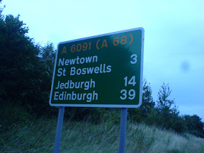
After Melrose, I decided it would be better to head back home rather than continuing south on the national cycle network. At that point I seen a distance sign that said that Edinburgh was 39 miles away on the A68. At that point I predicted that I'd be home some time between 12 midnight and 1 am.

As I was heading up the first part of the A68, which was quite a bit of uphill, I was starting to extend my prediction as to the estimated time of arrival home. However the downhill at the other side made up for the extra time to get up the hill, with me arriving home around quarter past midnight. 96 miles in 9 hours 45 minutes is pretty good, with a few breaks. It is however only a third of the speed required for setting some UK Road Records.

While I was out on my travels, I collected a nice track log of  my journey, so that I could add it to OpenStreetMap.org.

Sunday, July 29, 2007

Cycling: Edinburgh Critical Mass: July 2007

On Friday I went along to the monthly Critical Mass again.


I managed to arrive just in time this month for them setting off from the foot of the Mound at 6pm. This month seems to have been busier that the previous two months. There was about 44-55 people on their bikes there.

This month there was no major problems. Unfortunately at a few points there motor vehicle getting into the middle of the group, but we managed to sort that out quite quickly. Also on our way up Leith Street, when we were stopped at the traffic lights, there was two police cars coming up behind us with their sirens blaring and lights flashing. Unlike motor vehicles, we were able to rapidly shift over to one side of the road and on the pavement and let them past.

In true Critical Mass style at the last minute, we decided to head to an off-licence and then the Meadows for the after cycle drink and chat instead of the usual trip to The Peartree pub.

Unfortunately the GPS has gobbled my GPS logs again, so I had to re-create the route from memory.

Saturday, July 28, 2007

Cycling: Glasgow to Edinburgh

On Thursday evening, I took the train over to Glasgow for the Scotlug meeting. There was an interesting presentation about phidgets. Afterwards I went along with the other geeks to the pub to grab something to eat and have a natter. I've even now seen an iPhone (not just in pictures), though not yet had a chance to play with one.


After 11pm, I set off back to Edinburgh. On my bike. I could have taken the train, but that would have cost more and I was needing the challenge of cycling over night home.

I headed North from George Square to the Glasgow spur of the Forth and Clyde Canal. I then followed the Forth and Clyde Canal, the whole way to the Carron Sea Lock, where I then hit the road for the rest of the way home (except the cycleway parallel to the A90 from Dalmeny to the Crammond Brig pub, where cyclists are not allowed on the trunk road).

By the time I was nearing South Queensferry, first light was starting to show. See the picture below, where you can just about make out the towers of the Forth Road and Rail Bridges.
From 20070727Glasg...

The journey took 5 hours, and was about 53 miles in length. It's not very often you'll see me arriving home at 4:20 am.

The greatest thing about cycling at night is that the roads are really quiet, especially after 1am. It also makes cycling on the bigger roads a lot easier, and saves you from having to use the quieter and hillier routes. It can also be faster as you don't have to deal with other traffic or air turbulence caused by other traffic.

I'd be quite happy to do it again, as long as I don't need to get up the next day before lunch time.

Saturday, July 07, 2007

Some people thought that I done a lot of cycling?


Many people have commented on the various day cycling trips that I've taken. However yesterday when shopping, I found someone who has been doing a lot more cycling than myself. He took the train from Cambridge up to Inverness. Then he started cycling and camping rough. That was two months ago. 


He was taking everything he needed in panniers on his bike. He was looking at doing around 50 miles each on the way back down to Cambridge.

See the attached photo of his bike with the panniers full.

Sunday, July 01, 2007

Cycling: Critical Mass: Edinburgh June 2007

On Friday I headed to the Edinburgh Critical Mass again. It was a lot busier than last month, which meant that it was better perceived by the public.


As the route of the Critical Mass is not predefined, it is very easy to change the route. When we tried to turn right from Princes Street into North Bridge, no vehicles were allowed, so instead we headed down Leith Street.

Part of the Critical Mass route (I was late so it's missing the start).

After Critical Mass, I took a little detour home by going via Crammond Island.

I've stuck the photos on to Flickr seemingly Yahoo maps doesn't actually have Crammond Island.

Saturday, June 30, 2007

Cycling: Stirling to Glasgow

Last Thursday I was in Stirling for a presentation in the morning. I took the train out, so that I was able to be out there for the start of the presentation at 9:30. Unfortunately as I was travelling before 10am and it was not yet July or August, I had to pay the full fare of £5.80, rather than get a third off with the Young Person Railcard. I'll need to keep in mind that for the next 2 months, I'll be able to get the discount even when travelling before 10am Monday to Friday.


After the presentation finished at lunch time I cycled to Glasgow for a Scotlug meeting, where there was a presentation by Chris Fleming about OpenStreetMap.org. It took about 5 hours, including some time for a few breaks. Unfortunately there was some rain showers on the last half of the Cycle from Stirling to Glasgow. At one point it was so heavy that I decided to hide under one of the bridges that go over the Forth and Clyde Canal to let the heaviest of the rain to pass over.

As it had been so wet, I decided to take the slow train home, otherwise I would have cycled through the night back to Edinburgh.

Thursday, June 14, 2007

Cycling: Edinburgh to North Berwick

Last Night I took a cycle out to Prestonpans. I then took the train to North Berwick for £2.50, and cycled all the way back to Edinburgh. 


I was originally going to cycle to North Berwick, though unfortunately I had a head wind, which would have meant I would have missed the last train from North Berwick towards Edinburgh. The route that I changed to was also cheaper, because if I had gone all the way to North Berwick to take the train back, I would have taken the train all the way back to Edinburgh. That would have cost nearly twice as much.

I have also got the North Berwick branch line and the coast road into Edinburgh mapped on to OpenStreetMap.org. The signal of the GPS on the train wasn't perfect the whole way

Maps:
Edinburgh -> Presontpans (16 miles about 1 hour 20 minutes)
North Berwick -> Edinburgh (30 miles about 2 and a half hours)